


I’ve upgraded the Cargo Shorts Watch to a Warning for Sunday afternoon for all of southern Minnesota. Doppler may even pick up a few blips of cargo or camo shorts from a few intrepid weather souls up north.
The warmest air mass in almost 5 months blows into Minnesota this weekend. The last time the Twin Cities hit 60 degrees was October 20.
Springlike air mass
There’s no doubt about the inbound air mass. Widespread temperatures in the 60s are pooling across the central Plains Friday. I saw 70s in the downslope warmed areas of eastern Colorado Friday afternoon. Southerly winds will push the mild air mass bodily north into Minnesota Saturday.
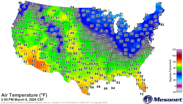
Temperatures Friday afternoon
Oklahoma Mesonet
Warm upper air pattern
Meteorologists watch upper air patterns for large-scale temperature trends at ground-level. A big ridge of high pressure across the central U.S. is ideal for pumping milder than average air into the Upper Midwest. The upper air pattern continues to look very un-March these days. More like late April.
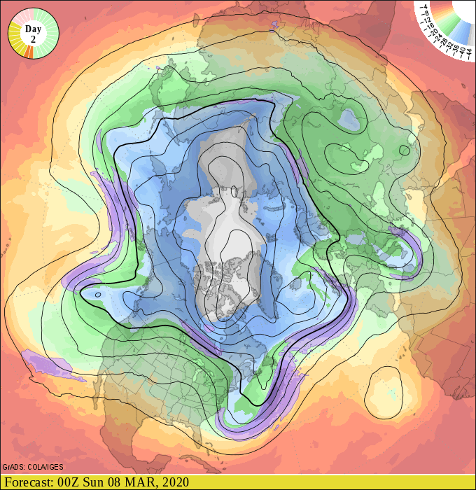
Upper air forecast map for 6 pm March 7
NOAA
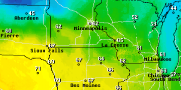
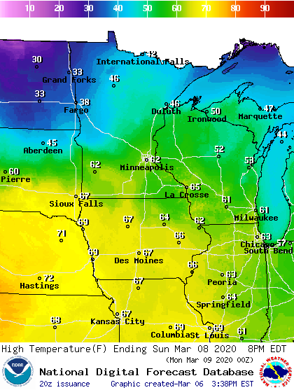
60s at least
Forecast models and all meteorological signposts and tea leaves point to highs in the 60s for southern Minnesota Sunday afternoon. I still think the numbers could be a little conservative for Sunday. I won’t be surprised to see 70 degrees on a bank thermometer or official weather station somewhere in southern Minnesota Sunday afternoon. Note the cooler temperatures north of the warm front across northwest Minnesota.
High temperature forecast Sunday
NOAA
Cooler next week
Next week looks cooler, but still above average. March is off and running about 9 degrees warmer than average so far in the Twin Cities. We’ll stay in above average territory right through next week.
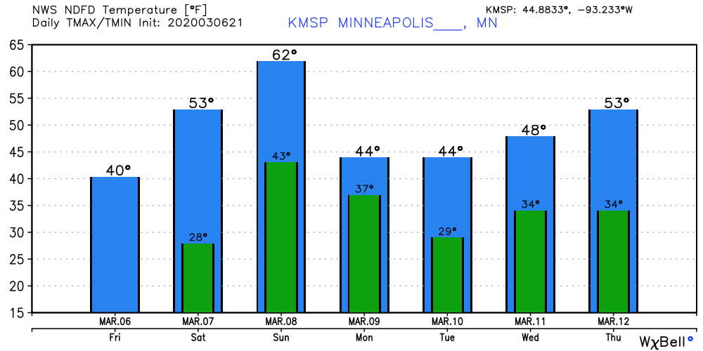
Temperature forecast for Twin Cities
NOAA via Weather Bell
I’m still looking for the proverbial other wintry weather shoe to drop later in March. So far I still don’t see it flying through the air.
Stay tuned.


